
Toothpony
Gazza minuta
- Usual depth10–40 m
- Water temperature21–29 °C
- Best monthsNovember
- How commonOccasional
About this species
Gazza minuta, the toothpony or toothed ponyfish, is a species of marine ray-finned fish, a ponyfish from the family Leiognathidae. It is found in the Indo-Pacific from the Red Sea and the east African coast east through the Indian and Pacific Oceans to Australia and Tahiti north as far as the Ryukyu Islands. It occurs over sandy and silty bottoms, although the young prefer mangroves and silty reefs. it feeds using its protruding pipette-like mouth or using the gill rakers as seives. Its food consists of smaller fishes, crustaceans and polychaetes.
Text from the Wikipedia article “Gazza minuta”, licensed CC BY-SA 4.0. Read the article
Where and when
Where it has been recorded
Worldwide
Loading the map
Best months
Worldwide (open data)
- January: 5 records
- February: 18 records
- March: 8 records
- April: 21 records
- May: 14 records
- June: 16 records
- July: 11 records
- August: 7 records
- September: 11 records
- October: 19 records
- November: 95 records
- December: 16 records
Depth and water temperature
Depth
Mostly recorded at 10–40 m · Deepest record: 111 m
Water temperature
Recorded in surface water of 21–29 °C
Names and classification
- English
- Toothpony, Ponyfish, toothed ponyfish, Toothed Pony-fish, toothed soapy, toothpony
Names in 4 more languages
- French
- Sapsap dentu
- Japanese
- Kobanhiiragi, コバンヒイラギ
- Thai
- ปลาแป้นเขี้ยว, ปลาแปบทะเล
- Simplified Chinese
- 小牙鰏, 小牙鰏 (橢圓鰏), 花令仔, 金錢仔
Other scientific names: Equula dispar, Equula minuta, Gaza minuta, Gazza argentaria, Gazza dispar, Gazza equulaeformis, Gazza equulasformis, Gazza equuleformis, Gazza minuata, Gazza tapeinosoma, Scomber minutus, Zeus argentarius
Similar species
- Large-toothed Ponyfish
Gazza achlamys
- Long-spined Pony-fish
Equulites leuciscus
- Orangefin ponyfish
Photopectoralis bindus
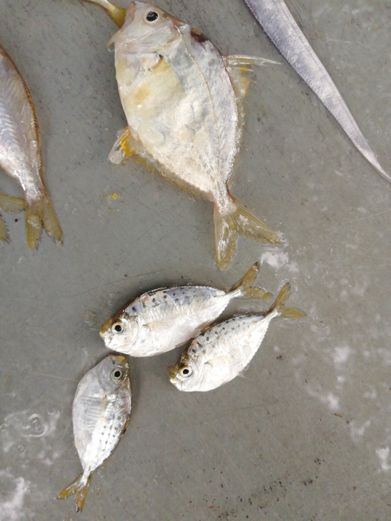 pugnose ponyfish
Deveximentum insidiator
- Elongate Ponyfish
Equulites elongatus
Sources and credits
Names and taxonomy: WoRMS (CC BY 4.0) and the GBIF Backbone (CC BY 4.0). Photos: iNaturalist observers, each under the licence shown (CC0, CC BY or CC BY-SA).
- Depth, temperature, months and maps: records from OBIS and GBIF under CC0 or CC BY.
- Descriptions: Wikipedia, licensed CC BY-SA, each linked to its article.
- Conservation status as published by GBIF (IUCN Red List).
- 1,081 open-data records from 1915 to 2024.
Log what you see on your next dive
The free DiveHive diver app keeps your logbook with every sighting and shows what lives at the site you dive next.